

€ 11.90

Sponsored links
|
|
€ 11.90 |
To Shop
|

|
€ 11.90 |
To Shop
|
| COMPARE ALL WEBSHOPS (2) | ||
 Description
Compare webshops (2)
Sponsored links · Some shops pay us a fee
€ 11.90
€ 11.90
Shops with other sizes
Description
(1)
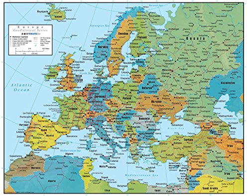
Detailed Political & Physical Europe Map – Shows countries, capitals, major cities, rivers, lakes, coastlines and relief shading for clear and accurate geographical understanding. Laminated & Wet-Erase Compatible – Durable gloss lamination suitable for wet-erase or dry-wipe markers, ideal for lessons, route marking, notes and revision. Ideal for Classroom, Home or Office – A versatile educational resource for geography teaching, homeschooling, study areas, offices and travel planning. A2 Size (42 × 60 cm) for Clear Wall Display – Large enough for excellent clarity while fitting neatly on walls, doors, boards and learning spaces. Printed in Ireland and designed by Swiftmaps – Crisp print detail, vibrant colours and long-lasting laminated durability.
 Related results
 Product specifications


